As the world warms and precipitation that would have generated snowpack instead creates rain, the western U.S. could see larger floods, according to new Stanford research.
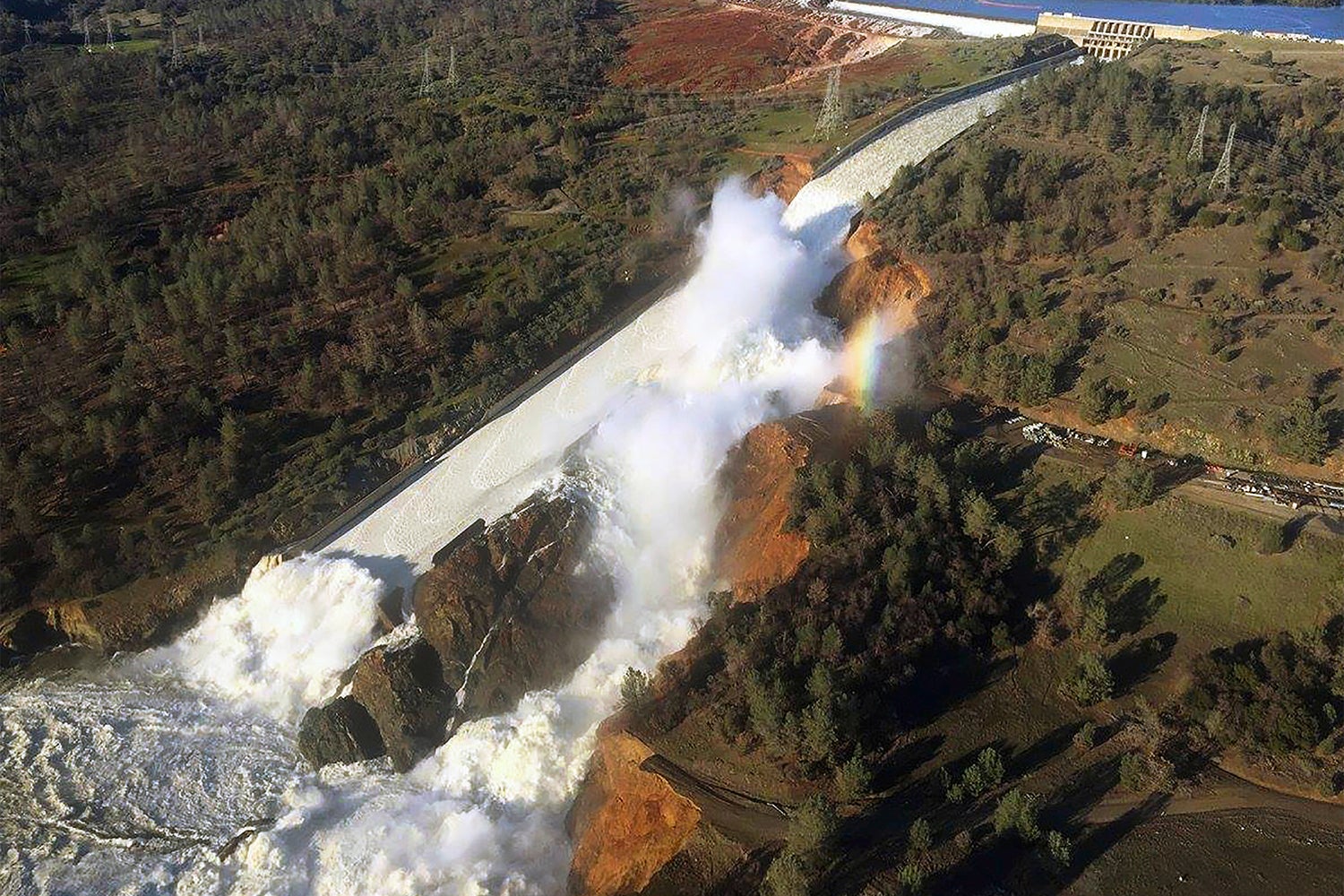
Water flowing from the eroded overflow spillway of Oroville Dam, California, on Feb. 11, 2017. New research offers insight into how flood risks may change in a warming world that has less snow. (Image credit: William Croyle, California Department of Water Resources / Wikimedia Commons)
An analysis of over 400 watersheds from 1980 to 2016 shows that winter floods driven by rainfall can be more than 2.5 times as large as those driven by snowmelt. The researchers also found that flood sizes increase exponentially as a higher fraction of precipitation falls as rain, meaning the size of floods increased at a faster rate than the increase in rain.
The study, which appears in the January issue of Water Resources Research, is particularly salient for people planning infrastructure while taking global warming into account. As Northern Californians saw during the Oroville Dam crisis in 2017 when a spillway failure forced more than 180,000 residents to evacuate, warm storms can pose big problems.
“The Oroville Dam crisis is a good example of how existing infrastructure is already vulnerable to flooding,” said lead author Frances Davenport, a PhD student in Earth system science at Stanford’s School of Earth, Energy & Environmental Sciences (Stanford Earth). “These results show that warming alone – even without changes in precipitation amounts – could lead to changes in the size of floods.”
While it might seem obvious that a greater fraction of precipitation falling as rain would cause bigger floods, the new research reveals that rainfall and flood size have a non-linear relationship. For example, a storm with 100 percent rain has 25 percent more liquid precipitation than a storm with 80 percent rain, but the researchers found that the average flood is 33 percent larger, meaning that the floods grow at a faster rate than the increase in liquid precipitation.
Future infrastructure needs
The results could inform management of reservoirs that not only secure the region’s water supply but also provide a buffer for flooding, according to senior author Noah Diffenbaugh, the Kara J. Foundation Professor at Stanford Earth.
“Planners are being asked to project forward what kind of conditions today’s infrastructure will have to withstand in the coming years and decades,” Diffenbaugh said. “Both the shape and magnitude of our non-linear results have the potential to benefit planners in Western states that are trying to integrate the changing nature of snow hydrology into their decisions.”
The researchers evaluated 410 watersheds using daily streamflow measurements from the U.S. Geological Survey to identify the largest precipitation events and the time periods with the highest streamflow. They then analyzed these events by comparing the amount of rain, snow and snowmelt leading up to and following each event.
In collaboration with economist and co-author Marshall Burke, an assistant professor of Earth system science, the researchers adapted methods from econometrics – a branch of applied statistics – to account for other influences like soil characteristics, slope and land-use change, in order to tease out the impact of precipitation alone. According to the authors, the analysis is one of the early attempts to apply these econometric techniques to hydrology.
“By using this econometric method, we can look at how flooding has varied across the full range of historical variability in each watershed,” Davenport said. “This allows us to identify patterns that may not yet be evident in long-term flooding trends.”
The results are useful to water managers thinking about long-term flood risks, especially in areas expected to experience warming and continued variability in the total amount of precipitation, according to the researchers. They were motivated to focus their analyses on the western U.S. because the same dams and reservoirs used to store water for the dry season also provide flood control during the wet season, with snow playing an important role in each.
“We’ve seen in recent years the real-time tension between keeping water in the reservoir so it can be used later in the year, and letting it out so that there’s space available to prevent flooding from the next storm,” said Diffenbaugh, who is also the Kimmelman Family Senior Fellow at the Stanford Woods Institute for the Environment. “States like California are well aware that as the snow hydrology of the western U.S. continues to change, the infrastructure that was designed and built around the old climate of the last century will continue to be pushed to its limits. Our results shed new light on how rapidly planners can expect extreme runoff to intensify as precipitation becomes more dominated by rain throughout the region.”
Co-author Julio Herrera-Estrada conducted research for the study while a postdoctoral researcher at Stanford Earth. Diffenbaugh is also an affiliate of the Precourt Institute for Energy. Burke is a center fellow at the Freeman Spogli Institute for International Studies and, by courtesy, at the Woods Institute for the Environment.
Funding for the research was provided by Stanford University.
To read all stories about Stanford science, subscribe to the biweekly Stanford Science Digest.
Media Contacts
Noah Diffenbaugh, School of Earth, Energy & Environmental Sciences: (650) 223-9425, diffenbaugh@stanford.edu
Frances Davenport, School of Earth, Energy & Environmental Sciences: fvdav@stanford.edu
Danielle Torrent Tucker, School of Earth, Energy & Environmental Sciences: (650) 497-9541, dttucker@stanford.edu
Author
Danielle Torrent Tucker