In brief
- Jasper Ridge has used aerial imagery in research and land management for decades.
- Historic aerial photos provide valuable data for understanding environmental changes over time.
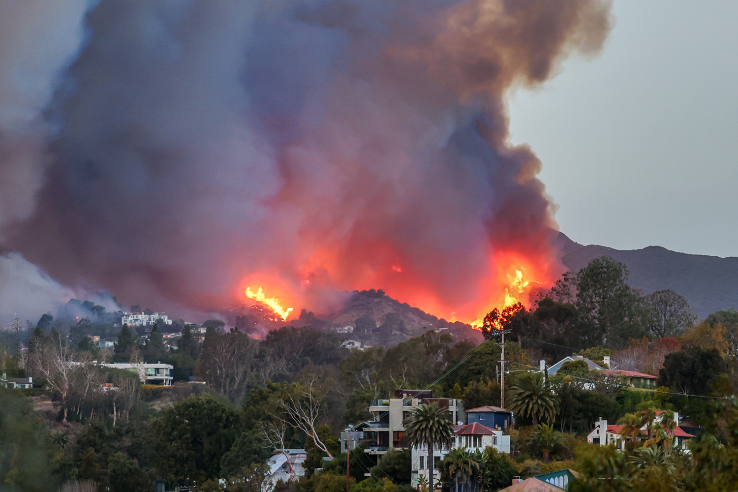
- Aerial imagery can be particularly helpful in wildfire research and risk management.
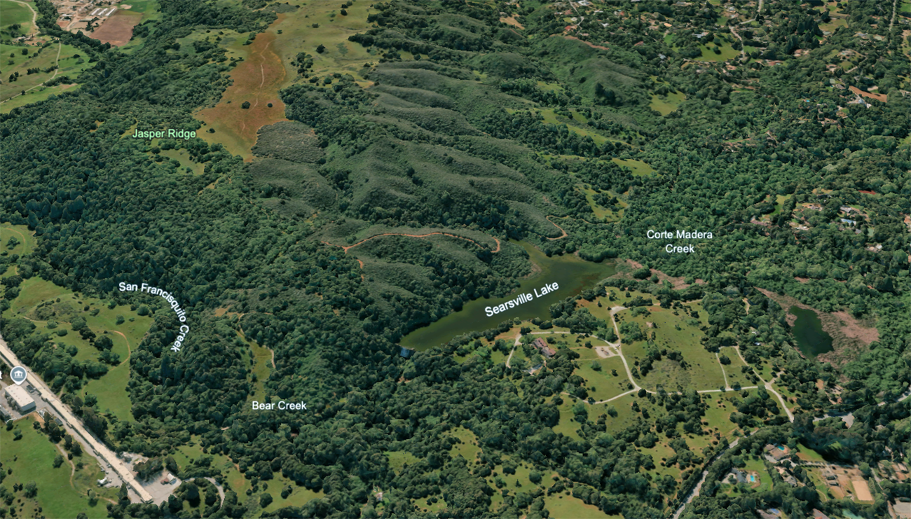
To understand how fire transforms a landscape, Daniel Neamati needs a bird’s-eye view of Jasper Ridge Biological Preserve ('Ootchamin 'Ooyakma), which spans nearly 1,200 acres in the eastern foothills of the Santa Cruz Mountains.
“That top-down view is really important,” said Neamati, a PhD student in aeronautics and astronautics and a TomKat Center Graduate Fellow for Translational Research working with Associate Professor Grace Gao. “My research would not be possible without it.”
Neamati recently studied how to improve GPS accuracy using 3D environmental models. He’s now applying that expertise to wildfire management – before, during, and after prescribed burns.
After prescribed burns were conducted at Jasper Ridge last year, Neamati and his team at the Navigation and Autonomous Vehicles Lab began analyzing imagery captured from the ground, sky, and space. Together, these layered perspectives offer a comprehensive and dynamic view of how vegetation responds to fire over time. He’s also beginning to review historic aerial imagery of the preserve.
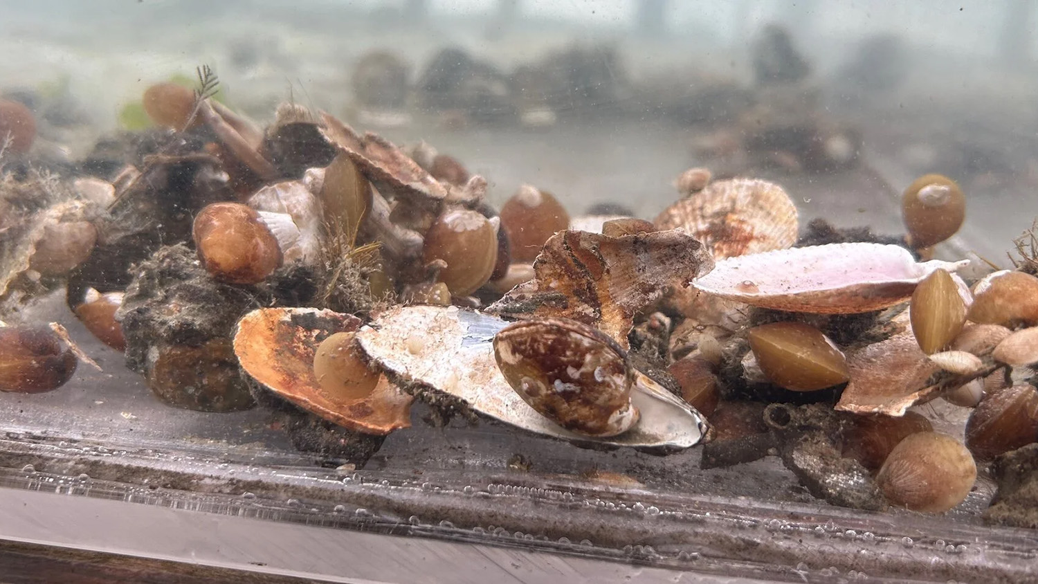
Neamati is particularly interested in the return of the rare, locally endemic plant called western bewildering bushmallow (Malacothamnus arcuatus var. arcuatus) following the prescribed burns. To track its resurgence, he uses photos taken by researchers at the site, drone imagery captured by Jasper Ridge staff, and satellite imagery accessible through resources at the Stanford Geospatial Center. Each perspective differs greatly in resolution, coverage, and frequency, but together, the images provide valuable research data.
“Aerial imagery really does change your perspective,” Neamati said. “You start to connect the dots in a way that you wouldn’t be able to see from the ground.”
Kites, pigeons, and planes
The world’s first known aerial image was captured in 1858 with a hot air balloon. In the years that followed, people used everything from kites to pigeons to take images from above, and the new technology was quickly used for military reconnaissance.
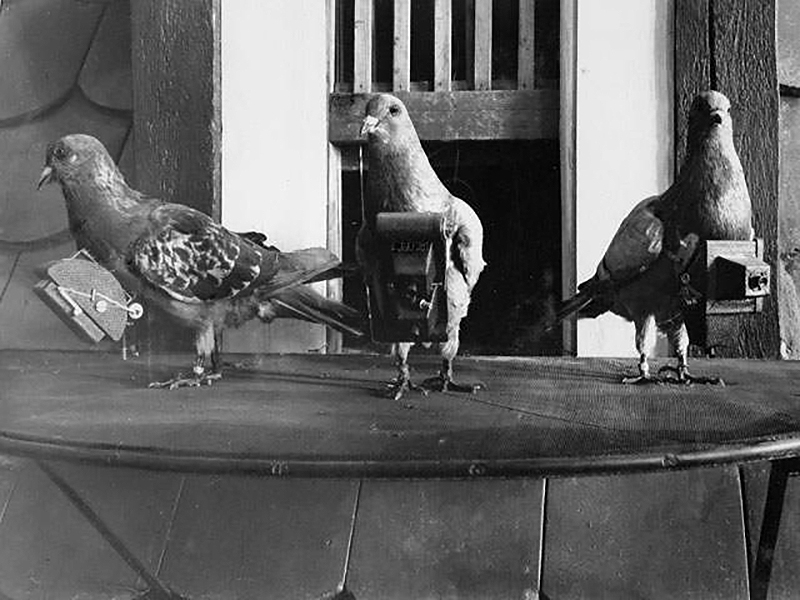
In 1907, a German man created aluminum harnesses to attach tiny, lightweight time-delayed cameras to pigeons as part of reconnaissance work. | Deutsches Museum, Munich, Archive, BN06463
Today, resources like Google Earth readily provide high-quality aerial imagery.
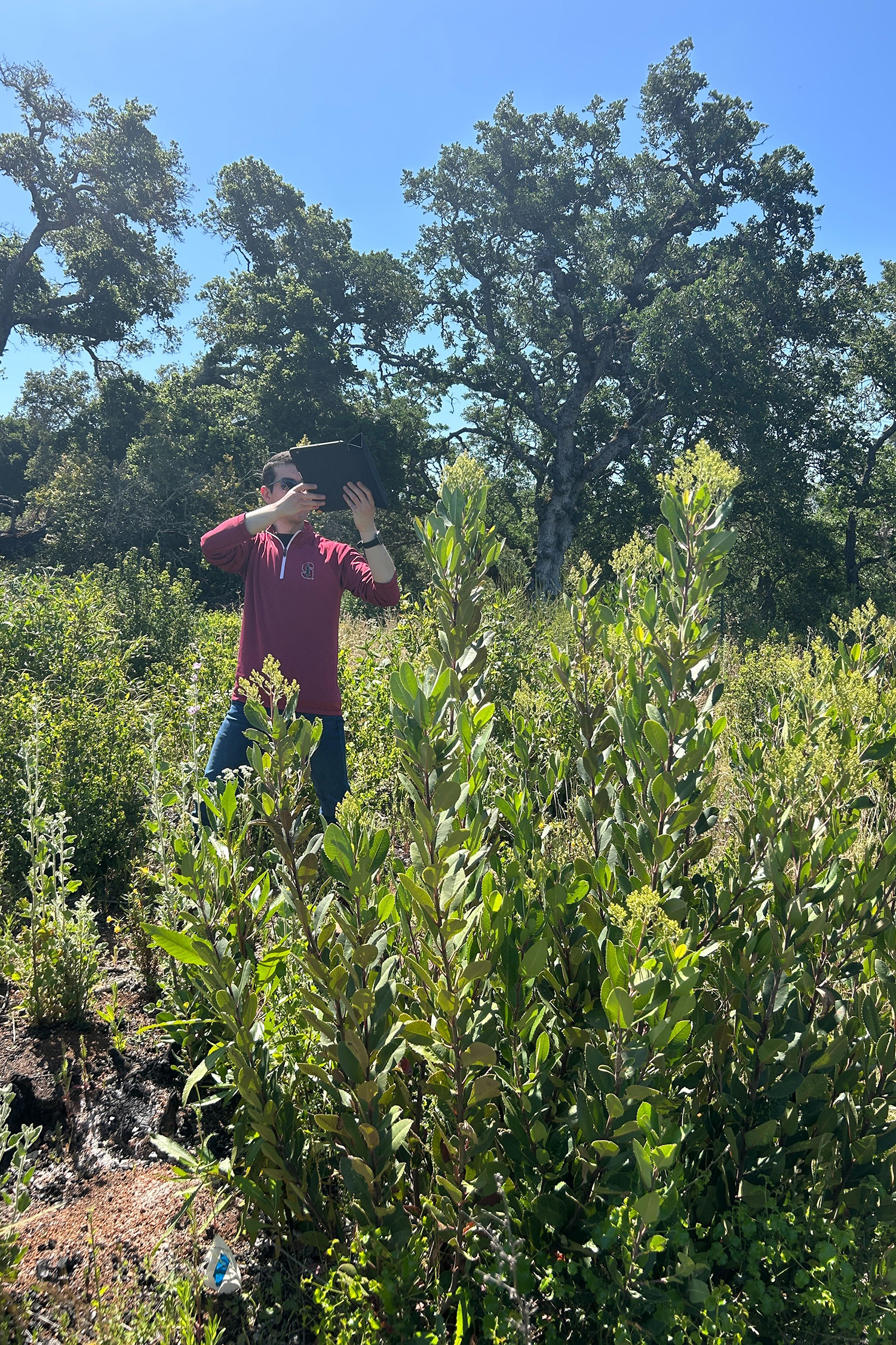
Daniel Neamati captures ground-level imagery of bushmallow, a locally endemic plant that is recovering following prescribed burns. | Evan Twarog
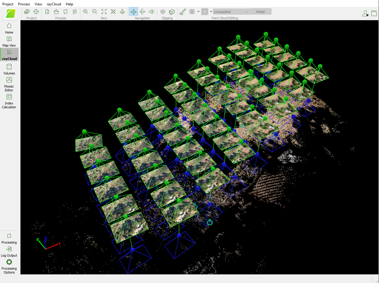
Pix4D photogrammetry software can combine drone altitude, GPS coordinates, and camera lens characteristics to generate 3D landscape models with accurate distance and compass directions. | Courtesy Trevor Hébert
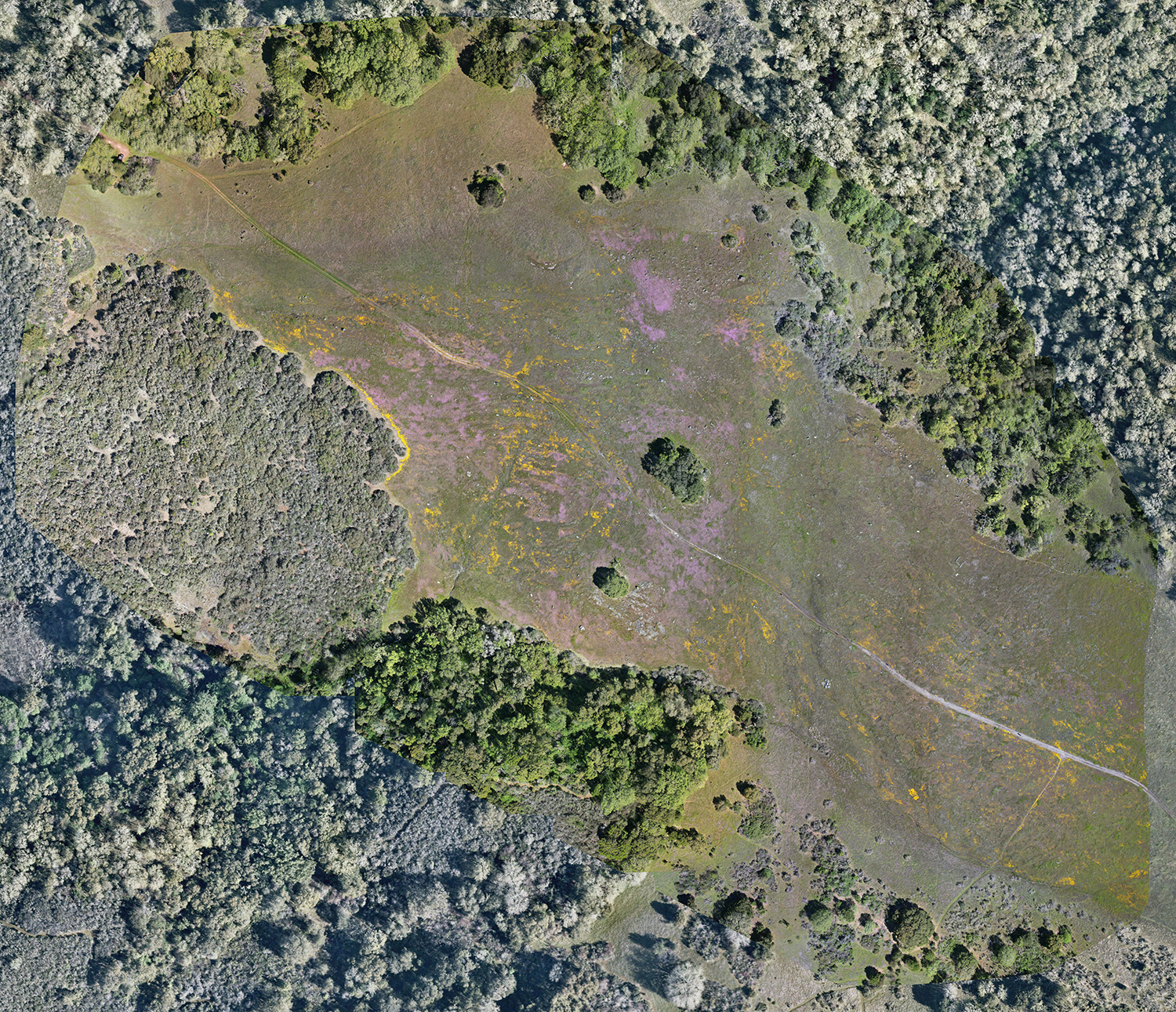
Recently captured aerial imagery shows a wildflower bloom. | Trevor Hébert
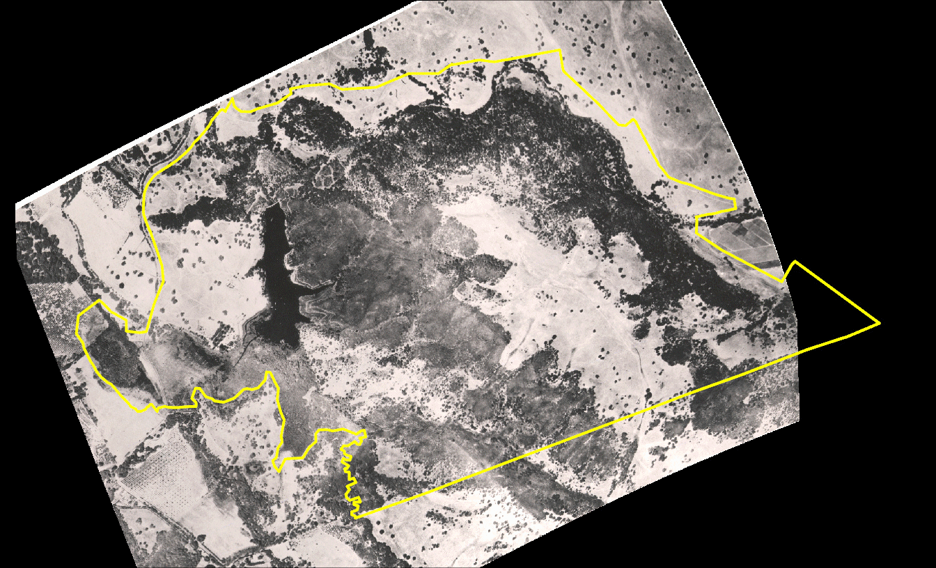
The first known aerial photo of Jasper Ridge, which is part of the School of Humanities and Sciences, was taken in 1928 when the university hired a company to conduct an aerial survey of Stanford’s lands. It was likely completed with a camera mounted to a Fairchild FC-2, which was the first aircraft specifically designed for aerial photography with a closed cockpit and a camera bay underneath, said Trevor Hébert, an academic technology specialist at Jasper Ridge.
“That really was kind of the dawn of aircraft aerial photography,” Hébert said. “It reflects Stanford’s leading-edge position on a lot of technologies through time.”
The 1928 photo shows more open grassland at Jasper Ridge than exists today, raising questions for fire ecologists about how such landscapes were maintained without fire, Hébert said.
The second-oldest known aerial photo of Jasper Ridge is from 1948 and was taken during early U.S. Geological Service efforts to map the country from above.
After World War II, government agencies and land managers began to rely on aerial photography to make more accurate maps and identify landmarks that are not easily accessible by foot or vehicle, like much of Jasper Ridge’s steep, rugged terrain.
For years, Stanford hired a company to conduct aerial film photography flights over Jasper Ridge, but it was expensive and could only occur every few years. The arrival of services like Google Earth and USDA flights improved access, but the real game-changer came a decade ago with drones.
“This has been revolutionary to be able to have that kind of high-frequency imagery,” Hébert said. “Being able to put the drone up whenever we need to take photos is really an amazing thing.”
Drones offer stability, precise flight paths, and the ability to capture low-altitude images.
Specialized photogrammetry software also combines drone altitude, GPS coordinates, and camera lens characteristics to generate seamless aerial imagery and 3D landscape models with accurate distance and compass directions.
“It’s no small feat to do that, because the camera lens field of view combined with perspective introduces some distortion into the photo,” Hébert said. “The software actually corrects for angle distortion – a process called orthorectification – and stitches the photos together. It’s pretty impressive.”
Applying technology
Hébert uses both historic and modern imagery to create the preserve’s vegetation maps, which nearly every researcher at Jasper Ridge relies on to locate field sites and contextualize their work.
The first known aerial photo of Jasper Ridge Biological Preserve ('Ootchamin 'Ooyakma) was captured from a plane in 1928. Technology has since evolved to high-resolution imagery captured by drones and satellites. | Photos provided by Jasper Ridge Biological Preserve ('Ootchamin 'Ooyakma); GIF created by Andrew Brodhead
Jasper Ridge researchers often use remote sensing, a field of spatial science that uses large data sets of multispectral imagery from satellites to obtain information about the Earth’s surface. For example, chlorophyll brightly reflects near-infrared light in healthy plants and can be used to measure vegetation health over a wide area.
AI may soon accelerate these efforts by processing vast image datasets and identifying patterns and details in vegetation change, Hébert said.
Jasper Ridge Faculty Director Tadashi Fukami noted the preserve has long been a test bed for new remote sensing technologies. In the mid-1980s, Stanford and Carnegie scientists pioneered using remote sensing at Jasper Ridge to study how nitrogen limitation affects plants’ carbon dioxide absorption. In the 1990s, the NASA Jet Propulsion Laboratory flew an aircraft over Jasper Ridge with the most advanced remote sensing instrument at that time, the Airborne Visible/Infrared Imaging Spectrometer (AVIRIS), creating a data-rich image that is still used in research projects and remote sensing training for scientists worldwide. The image was used to develop the Normalized Difference Water Index, a widely cited method for measuring water in vegetation.
As the preserve continues its work guided by local Indigenous communities to revitalize cultural burning, Fukami also hopes to use aerial imagery to help bridge traditional practices with new technology.
“This is a powerful tool,” Fukami said. “We’re interested in biomass changes, and the new technology used for that purpose can support cultural revitalization efforts.” Fukami is a professor of biology in the School of Humanities and Sciences and of Earth system science in the Stanford Doerr School of Sustainability.
Land management
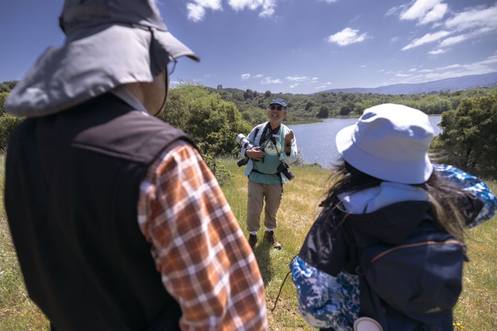
Aerial imagery isn’t just for research – it’s also a regular tool for preserve staff overseeing wildfire fuel reduction, research site selection, invasive species monitoring, and infrastructure projects.
“It helps you picture landscape-level changes,” said staff scientist Sheena Sidhu. “With fuel reduction, we’re trying to mitigate the risk of wildfire spread at the borders of the preserve. We use aerial imagery to look at the fuel loads to help plan where modifying vegetation could change wildfire behavior and slow down spread as it's moving through the landscape.”
After recent prescribed burns, staff used drones to visualize changes in vegetation and overlay those images with burn locations to identify vegetation patterns.
“You want to see both when doing landscape management,” Sidhu said. “We’re seeing that some vegetation patterns actually follow some of the pile burn rings, and while we do measure on the ground as well, to see it visually allows you to quickly and easily map the area.”
The imagery also helps guide decisions for staff and researchers about where to place transects for measuring vegetative growth and develop plans on where future fuel reduction should occur, saving time and resources in the field, Sidhu said.
For invasive plant management, staff can use aerial imagery to quickly monitor removal progress.
“One of the most challenging things with invasive species is there’s a lot, and we only have so many resources available to manage them,” Sidhu said. “Aerial imagery can help us hone our resources and zero in on where we want to prevent, contain, or even eradicate populations before they spread.”
Writer
Chelcey Adami