Stanford scientist recalls discovering his drive to understand climate impacts in coastal areas
Years after Hurricane Katrina altered his life’s course, Elliott White Jr. set out to understand what drives coastal wetland loss as a way to help lessen harm from future climate impacts for vulnerable coastal communities.
In 2005, as Hurricane Katrina careened in from the Gulf of Mexico, on its way to becoming one of the deadliest and costliest disasters in modern U.S. history, Elliott White Jr. was 400 miles away from his New Orleans home, having evacuated with his family just a day earlier.

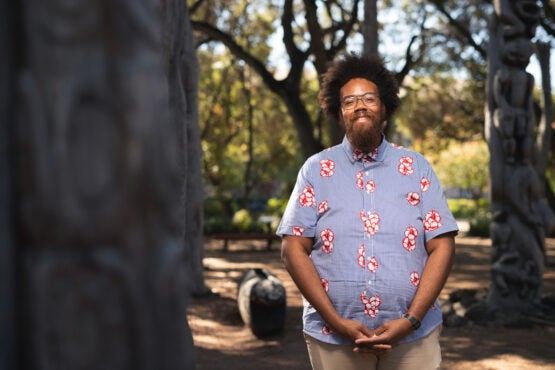
Elliott White Jr. is an assistant professor of Earth system science who studies the effects of climate change on coastal wetlands. (Image credit: Andrew Brodhead)
It was the beginning of seventh grade for White, who is now an assistant professor at Stanford University studying the effects of climate change on coastal wetlands. Historically, these ecosystems have helped to protect low-lying communities along the Atlantic and Gulf Coasts against storm surges and strong winds.
Although White grew up in Louisiana, home to 40 percent of the nation’s coastal wetlands, he first set foot in a wetland in Iowa, as an undergraduate doing fieldwork in the northern Great Plains’ ephemeral freshwater marshes known as prairie potholes. White remembers the idea of studying wetlands occurring like an epiphany as he sat in his dorm room, knowing he wanted to pursue a PhD in something and pondering his journey from New Orleans to Ames, Iowa.
“I thought about how different my life would have played out if 100-years-plus of wetland degradation hadn’t happened in New Orleans before Hurricane Katrina – if there were many more miles of wetlands there to buffer the storm surge and reduce the strength of the storm before it made landfall,” said White. “I set out to pursue a research agenda and career to better understand coastal wetland loss, what drives it, so that then I can help with restoration efforts.”
After Hurricane Katrina roared ashore, it took hours for the first reports from New Orleans to reach White and more than a dozen relatives who had evacuated the area and piled into the two-bedroom home of a great aunt in Galveston, Texas. The day passed as if in suspended animation: “There’s really no news coverage because things are being destroyed. So, we’re just doing normal life stuff, like hanging out, watching TV, going to the playground,” he recalled recently outside his office on the Stanford campus.
In time, they learned that flooding had submerged up to 80 percent of New Orleans after levees designed to protect it broke. Damage in the region – made worse by decades of swamp drainage that had caused much of the city to sink below sea level – made it impossible to return as weeks and then months of the school year ticked away. So, although their home had emerged intact, White and his siblings were enrolled in the local Galveston school.
It would be close to a decade before he returned to Louisiana. In many ways, White said, he’s still working through the emotional toll of displacement, of being disconnected from cousins he’d once seen every day and having to make new friends in an unfamiliar space.
“That really drives the need for me to understand wetland change. Because hurricanes are going to keep happening. They’re going to get worse. Other children and other adults are going to experience many of these same things that you’re not prepared to deal with,” he said.
Several months after his arrival at Stanford as a new professor, in early 2022, White’s office remained spare. On one sunlit wall hung a painting of a shotgun-type house with glowing yellow windows reminiscent of the home where White grew up in New Orleans, and a simple colored-pencil drawing of the southern Louisiana/Mississippi River Delta. Beside it, on the whiteboard, he had written an all-caps reminder to focus on “why vs. what.”
Go to the web site to view the video.
Cypress swamp cathedrals
After college, White’s mission to understand coastal wetland loss took him to graduate school in Gainesville, Florida – a home base for research excursions to marshes along the coasts of Florida, Texas, and Louisiana, which are threatened by climate change-driven sea-level rise, rainfall changes, warming, and saltwater intrusion. “I’ve spent thousands of hours in hot, steamy wetlands,” usually wearing knee-high rubber boots, old cotton T-shirts, and $20 hunting pants from Walmart, White said. “It’s not for everyone. But whenever I’m in the wetland, it feels like home.”
Nature wasn’t accessible for White as a kid. “It wasn’t part of my parents’ experience, and they just didn’t have time for it,” he explained. “But we were always pushed outside.”
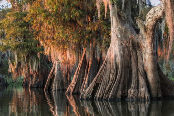
As a scientist, White has found himself particularly drawn to swamps where tall, fat-trunked bald cypress trees thrive. These ecosystems soak up floodwaters, sequester carbon, trap pollutants, support groundwater recharge, provide vital habitat for birds and wildlife, and are in rapid decline because of climate change, oil and gas production, and upstream dams. The way White describes them, the enormous trees also create a world tinged with far more beauty than the monster-ridden swamps of fiction would have us believe.

As a scientist, Elliott White has found himself particularly drawn to swamps where tall, fat-trunked bald cypress trees thrive. Pictured are bald cypress trees in Louisiana’s Atchafalaya Basin. (Image credit: Getty Images)
“It’s like my cathedral. The trees are the columns of this giant church. Because of the leaves, it’s dark, but some light gets through. It’s like stained glass, and it’s very quiet,” said White. “Those are the types of habitats where I find serenity, even though I’m focused on doing research and making sure we get all the data we need.”
Although White felt at home on research trips, he often questioned his belonging in academia. “Imposter syndrome was a very big part of my graduate school career,” recalled White. “Part of that was I was one of the few Black people in my department. Growing up, my mom would tell me, ‘when you go outside, you’re representing Black people.’ That, I guess, was always in my head, so I never wanted people to think, ‘Oh, why is Elliott asking so many questions, he’s not cut out for this.’ That hurt me early on.”
Finding connections
As he dug deeper into wetland sciences in graduate school, White discovered that he would need to zoom out to answer questions he had about how climate impacts vary across socioeconomic groups. That led him to remote sensing, a set of techniques scientists use to detect and monitor physical characteristics of an area at a distance, often by beaming radar or light down to Earth from satellites and measuring the return time.

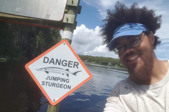
During graduate school in Florida, Elliott White’s research took him to the Suwannee River. (Image credit: Elliott White Jr.)
“Remote sensing allows us to take the scientific data, put it on the map, and allow others who don’t have the scientific literacy to understand their juxtaposition to different things,” such as the predicted depth of floodwaters at your home in the event of a hurricane, explained White, or the overlap between critical infrastructure and coastal hazards projected to increase with global warming – one of his current projects.
“For communities closest to the coast, they need to worry about the exposure of their electricity, drinking water supply, and wastewater treatment to extreme events,” White said. “Sea level rise, saltwater intrusion, and hurricanes each represent a threat to these systems.” In the coming years, White aims to have results that municipalities and water treatment managers can use to make their infrastructure more resilient.
By overlaying remote sensing data with household income data, White said, scholars are able to identify communities with greater exposure to a given impact of climate change, where people may need help moving away from threatened areas or where infrastructure investments may be necessary to protect lives and property.
The grand scale of this type of analysis can produce an incomplete picture, however, if researchers lack understanding of connections on the ground, White said. No amount of satellite or census data, for example, would reveal the social links that can make all the difference in whether a family can afford to evacuate before a big storm. To White, who is in the Stanford Doerr School of Sustainability’s Department of Earth System Science, that makes collaboration essential. “I’m trained as a natural scientist; I’m not trained as a social scientist. I try to partner with people who have more knowledge in that area, and work on proposals and come up with questions together, so we can produce knowledge that can be directly helpful to people without being extractive,” he said.
In the 17 years since Hurricane Katrina, most of White’s family has moved back to New Orleans. “Everyone is back in the same place, which is nice in some ways because I can see them all when I go home,” he said. “But then I think about future disasters and the scattering that’s going to happen again.”
To read all stories about Stanford science, subscribe to the biweekly Stanford Science Digest.
