In 2019, technologies like floating robots, waterproof tagging systems and satellites aided Stanford University researchers in their efforts to better understand and solve challenges facing our oceans, including warming waters, flooding and seafood sustainability.
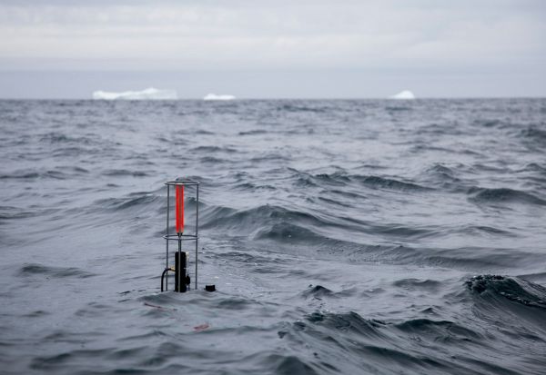
A robotic buoy outfitted with sensors as part of the Biogeochemical-Argo network floats in polar waters, taking measurements that help scientists answer questions about the composition of phytoplankton communities and the uptake of carbon dioxide by the ocean. (Image credit: P. Bourgain)
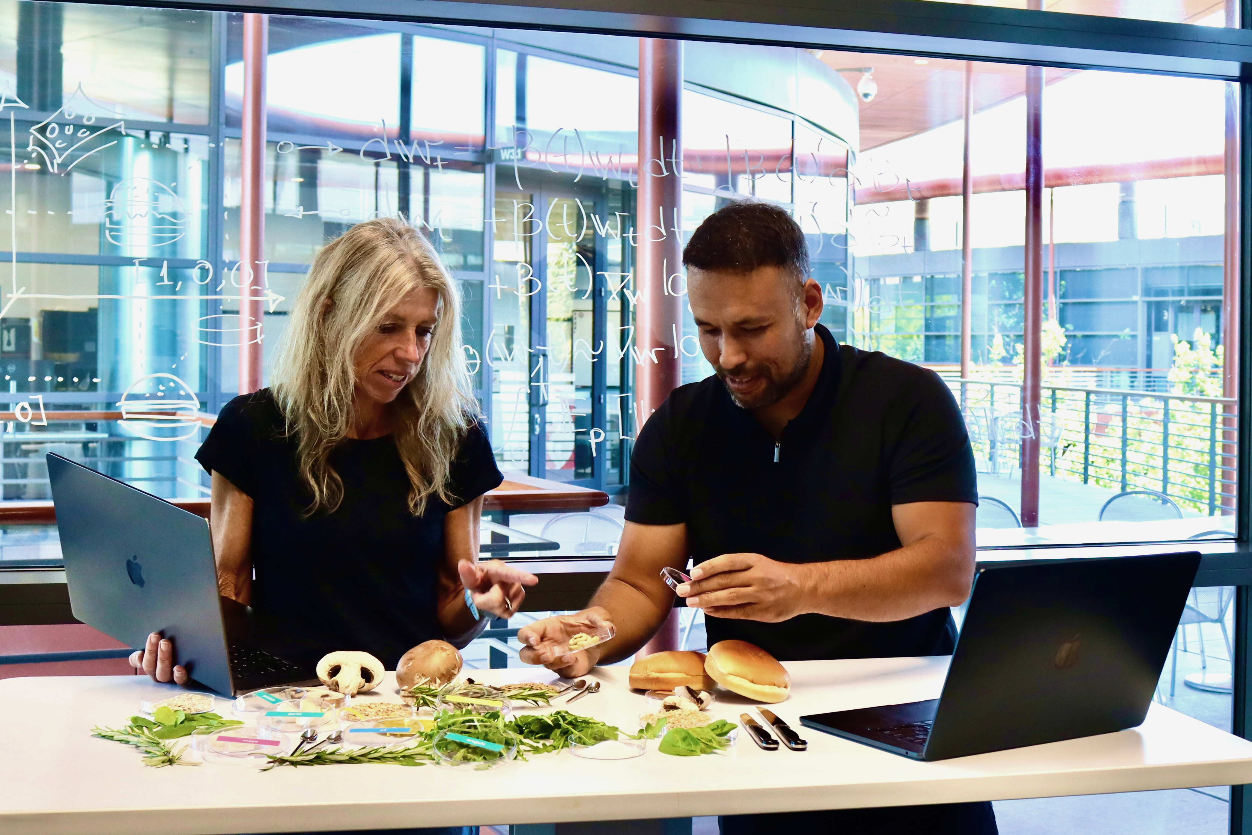
“For millennia, our ability to protect the health of the oceans has been hampered by the fact that it has been impossible to know very much about what is happening in the water or even on the surface,” said Jim Leape, co-director of the Stanford Center for Ocean Solutions, in a Q&A on food security. “That is now rapidly changing, as new sensors in the water, on satellites, on boats and even on fishing nets provide a new era of transparency in the use of ocean resources.”
Better understanding of the problems oceans, marine life and coastal communities are facing can lead to smarter action and policies to address these issues. This research also adds to fundamental knowledge about a massive piece of our planet that remains mysterious.
Probing ocean life
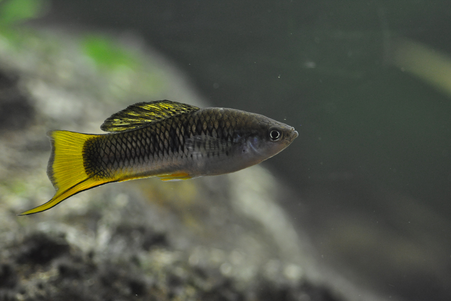
Ocean life, like algae and fish, form the backbone of many food systems – but there’s still a lot to learn about where those organisms live and the threats they face.
A fleet of robots that surfed the Southern Ocean between Antarctica and the African continent in 2014 and 2015 led researchers from the School of Earth, Energy and Environmental Sciences (Stanford Earth) to investigate two strange blooms of microscopic ocean algae. Seeing these phytoplankton blooms where nutrients are scarce, Kevin Arrigo, a professor of Earth system science, and Mathieu Ardyna, a postdoctoral scholar, combined satellite and floating buoy data with the robots’ reports and found that deep hydrothermal vents were welling up nutrients, creating oases for algae.
This finding was the first to show how iron rising from openings on the seafloor of the Southern Ocean could fuel these blooms and suggests these vents may affect life near the ocean’s surface and the global carbon cycle more than previously thought.
Other robotic measurements – along with fishing records, satellite data and biological sampling – helped William Gilly, professor of biology in the School of Humanities and Sciences, and his collaborators identify shifting weather patterns and warmer waters in the Gulf of California that have likely contributed to the collapse of jumbo squid fisheries in the area.
“You can think of it as a sort of oceanographic drought,” said Timothy Frawley, a former Stanford graduate student who worked with Gilly, in a story about the research. “Until the cool-water conditions we associate with elevated primary and secondary production return, jumbo squid in the Gulf of California are likely to remain small.”
In an attempt to gain a better understanding of where fishing occurs and where fish are, researchers, including Barbara Block, the Prothro Professor of Marine Sciences at Stanford, combined satellite tracking of fishing fleets with maps of marine predator habitats – determined using a decade-long tracking program called Tagging of Pacific Predators (TOPP) – to identify areas of overlap. Focusing on international waters in the northeast Pacific, the researchers found that vessels from Taiwan, China, Japan, the United States and Mexico accounted for over 90 percent of fishing in key habitat areas for seven shark and tuna species. Work like this could aid in developing more effective wildlife management on the high seas.
A closer look at pressing issues
In other research, technologies helped examine the ways oceans are changing and how rising seas impact our life on land.
Hoping to improve predictions of sea-level rise, Dustin Schroeder, an assistant professor of geophysics at Stanford Earth, compared vintage ice-penetrating radar records of Thwaites Glacier – captured between 1971 and 1979 – with modern data. Schroeder and his team found the eastern ice shelf of the Antarctic glacier is melting faster than previously estimated.
“It was surprising how good the old data is,” Schroeder said, in a story about this research. “They were very careful and thoughtful engineers and it’s much richer, more modern looking than you would think.”
Meanwhile, in murkier waters, Oliver Fringer, professor of civil and environmental engineering at Stanford, has begun testing a drone equipped with a special camera, attuned to reveal high-resolution details of sediment flow and settling in the San Francisco Bay.
“Mud is not glamorous, but mud is where all the contaminants collect and stick,” noted Fringer, in a story by the School of Engineering. Studying these sediments can tell researchers a lot about the health of waterways and hint at how they may respond to climate change.
A coast away, Stanford researchers studied the effects of high-tide flooding that occurred in Annapolis, Maryland, in 2017. The researchers used parking meters, satellite imagery, interviews and other data to determine how would-be customers were dissuaded from visiting during flood hours at a popular business region near the water known as City Dock. They found the loss to City Dock businesses due to flooding was less than 2 percent of annual visitors but warned it could get worse as sea levels continue to rise.
“So often we think of climate change and sea-level rise as these huge ideas happening at a global scale, but high-tide flooding is one way to experience these changes in your daily life just trying to get to your restaurant reservation,” said Miyuki Hino, who was a Stanford graduate student when she worked on this research, in an article about the study.
Coastal hazards were also the focus of work in the Bahamas conducted by Stanford’s Natural Capital Project. These researchers combined information on storm waves and sea-level rise with census data and satellite maps to show the Bahamian government where investing in nature could provide the greatest benefits – and coastal protection – to people.
Using their open-source software, the researchers were able to map the coastal risk reduction provided by coral reefs, mangroves and seagrass along the entire coast of the country. Their findings are part of a growing body of research showing that natural defenses can represent more climate-resilient alternatives to traditionally built shoreline protection – like seawalls and jetties – which is expensive to build and maintain.
Arrigo is also a member of Bio-X and an affiliate of the Stanford Woods Institute for the Environment. Fringer is also a member of the Institute for Computational and Mathematical Engineering (ICME) and an affiliate of the Stanford Woods Institute for the Environment. Gilly is also a member of Bio-X and the Wu Tsai Neurosciences Institute, and an affiliate of the Stanford Woods Institute for the Environment. Leape is also the William and Eva Price Senior Fellow in the Stanford Woods Institute for the Environment.
To read all stories about Stanford science, subscribe to the biweekly Stanford Science Digest.
Media Contacts
Taylor Kubota, Stanford News Service: (650) 724-7707, tkubota@stanford.edu
Author
Taylor Kubota