
Stanford is stepping up its wildfire management efforts in response to changing weather conditions that are increasing the length and severity of California’s wildfire season. The university’s work includes a comprehensive and coordinated vegetation management effort around campus supported by a new wildfire management plan designed to take a regional approach to mitigation efforts and improve coordination with neighboring communities.
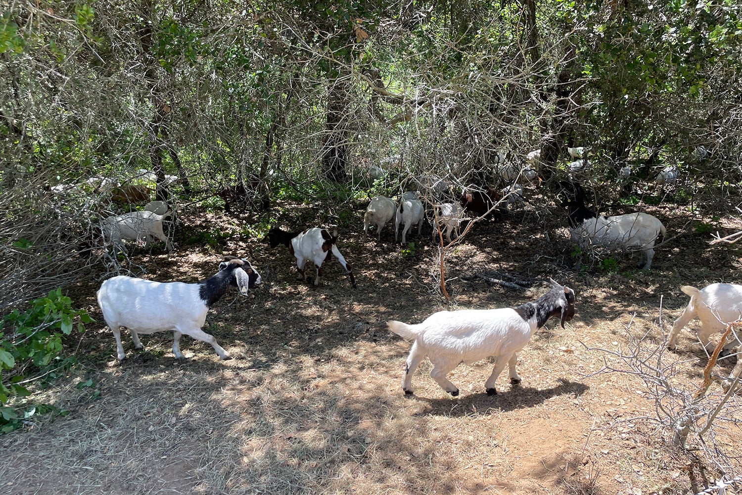
Stanford is using hundreds of grazing goats to clear combustible vegetation as part of its wildfire management efforts. (Image credit: Kevin Irwin)
The university’s main campus land covers 8,180 acres, much of which is undeveloped and populated with natural and sometimes dense vegetation and open grasslands, making it at risk for wildfires. The proximity of these undeveloped areas to academic and residential facilities on campus and structures in neighboring jurisdictions, combined with evolving wildfire conditions, spurred several Stanford units to convene a Wildfire Management Team tasked with looking more comprehensively at the university’s approach to wildfire prevention and management.
“Our proactive approach to planning for and reducing the wildfire risk, and successfully responding to those that occur, reflects our commitment to safely managing Stanford lands for the protection of our campus community and neighbors,” said Aaron McCarthy, university fire marshal and assistant director for environmental health and safety. “Longer and more intense wildfire seasons have magnified the risk of wildfire throughout the Bay Area, and we are adjusting our approach to meet the safety needs of the community and the operational needs of the university.”
The foundation of the current work was set three years ago when Stanford prepared and published its 2019 Wildfire Management Plan (WFMP). The recommendations in that plan have been implemented for the past few years in advance of the wildfire season, and include:
- Disking and flail mowing in the Dish area along Page Mill Road, Deer Creek Road, Coyote Hill Road, Felt Lake, and Sand Hill Road, which create important firebreaks.
- Line trimming to reduce the vegetation and create defensible spaces around the structures in the Dish area.
- Wildfire fuel reduction work around the Reynolds House at Jeep Trail and Golf Lane near Portola Valley, along the Matadero Creek (S1) Trail and Rural Lane, and line trimming at Piers Lane.
- Mowing in main campus open spaces, including the Arboretum area and roadsides, areas adjacent to Faculty Staff Housing roadsides, and Kite Hill.
- Line trimming in campus greenbelts, with additional work ongoing to reduce vegetation by removing dead material, shrub pruning, and lifting of tree branches to a minimum 8-foot clearance.
- Goat grazing in suitable areas, including the Jasper Ridge Biological Preserve, West Mare fuel break (a 14-acre stretch adjacent to Page Mill Road and Interstate 280), and East Gelding fuel break (behind Stanford Research Park between Coyote Hill Road and Deer Creek Road).
- Hand-thinning, removal, and chipping of Oak Woodland vegetation areas near the Woodside Horse Park, Webb Ranch, and along Page Mill Road, totaling more than 115 acres, with additional work planned for the summer of 2022.
A more comprehensive approach
Two years ago, Stanford assembled a group of experts in wildland fire science, forest ecology, and environmental planning to update and expand the scope of the 2019 plan. The goal, according to a summary of the new effort, “is to define a program of strategic wildland fuels and fire management, based on sound science and state-of-the-art risk modeling, to substantially reduce fire hazards on Stanford’s lands.” The expanded planning effort utilized innovative fire modeling tools and techniques that identified which parts of Stanford’s lands need priority actions given the landscape composition and weather patterns evidenced in other recent California wildfires.
One of the unique aspects of Stanford’s main campus and surrounding lands are that they extend across seven local government jurisdictions – Santa Clara County, San Mateo County, Palo Alto, Menlo Park, Portola Valley, Woodside, and Los Altos Hills. University officials are coordinating with these jurisdictions and the California Department of Forestry and Fire Prevention (CAL FIRE) to ensure Stanford’s wildfire prevention plan aligns with other local and regional approaches being undertaken by local fire departments, fire protection districts, and CAL FIRE. Stanford is also applying the same wildfire management principles and techniques in the WFMP to other university-owned lands in the area, including the 75-acre “Stanford Wedge” property in Portola Valley located near the intersection of Alpine Road and Westridge Drive.
“Wildfires don’t respect jurisdictional boundaries, and so it’s important that we take a regional approach to protecting the health and safety of local residents,” said Kelly Kline, associate vice president for government affairs. “We also want to be a resource for neighboring jurisdictions, agencies, and residents as they develop similar wildfire plans and take steps to safeguard homes and other property.”
Stanford is taking care to incorporate the latest resource protection strategies into its current actions and plans. By carefully incorporating vegetation management practices, the university hopes to minimize effects on biological, cultural, visual, and other resources as the university addresses wildfire concerns.
More information about Stanford’s ongoing wildfire management and planning work, including the complete Wildfire Management Plan, is available here.
Contributing to regional efforts
Another way that Stanford is contributing to wildfire management in the region is through participation in the ALERTWildfire camera network, a system of cameras deployed in the western United States, mostly across California, to help spot wildfires, pinpoint the location of observed fires and determine safe evacuation routes.
Three cameras are managed by staff at Stanford’s Jasper Ridge Biological Preserve – two that are primarily observing university lands and a third that monitors the City of Palo Alto’s Foothills Park. The cameras are also able to capture large areas beyond Stanford’s land, including the town of Portola Valley. Stanford is now looking at installing a fourth camera to provide additional coverage of the Stanford Research Park and supplemental artificial intelligence software to monitor the cameras 24 hours a day, seven days a week.
All of Stanford’s cameras, along with the rest of the network, can be viewed on the ALERTWildfire website.
Stanford is also participating in the Zonehaven evacuation management system being implemented by many Bay Area counties. The system provides agencies with tools for effective evacuation planning and execution and delivers instructions and updates to residents in the event of an evacuation. It is currently active in San Mateo County, including Stanford lands, and is being rolled out in Santa Clara County, although it has not yet been activated for the main academic campus area.