For Stanford geology undergraduates of past decades, the most impactful classrooms were often composed of sand, grass, rocks, and trees in a remote camp somewhere in the western United States. For weeks at a time, students in the Stanford Geological Survey field course, making maps of as-yet uncharted parts of California, Nevada, and Utah, produced the first recorded knowledge of the rock types, layers, and faults that reveal the history of how the land was formed.

Earth and planetary sciences Professor Emerita Elizabeth Miller looks at a hand-drawn geological map in her office in GeoCorner. (Image credit: Andrew Brodhead)
Now, the students who mapped Nevada’s Northern Snake Range as part of the Stanford Geological Survey in the 1980s and 1990s have their work on display in a kind of global gallery: The location has been named to the First 100 International Union of Geological Sciences Geological Heritage Sites.
“We didn’t have computers back then, so all our maps were hand-drawn and colored,” said Professor Emerita Elizabeth Miller, who led the Stanford Geological Survey from 1979 until its conclusion in 1995. “It was just an incredible amount of human energy and work walking these mountains and making a myriad of observations and measurements on the rocks.”
The legacy field class – six weeks in the field, four weeks at Stanford, 12 academic credits – ran for 100 years, from 1895 to 1995. Students and faculty went into the wilderness to learn about the composition of the Earth and how to accurately map it, a skill passed on from the graduate students and instructors to the undergraduates. Scientific information and artistic skills mesh together in map making, which is a fundamental approach for recording incredibly complex field geological data into a format that can help solve problems and answer questions in the Earth sciences.
“Geologic maps are essential because they tell you what’s there in terms of hazards, resources, and land-use evaluation,” Miller said. “Geologic maps are really important for our natural resource needs that will support the up-and-coming green energy future for this country.”
Geological treasure
Miller isn’t excited about the Northern Snake Range because of its resources – rather, for its incredibly unique geologic features. The site is an astonishingly well-developed example of a metamorphic core complex detachment fault, a type of fault formed during extension or stretching of the Earth’s crust. The fault places rocks broken by faults in the upper layers of the Earth against rocks deformed in a ductile, silly putty-like fashion at hotter temperatures at depth in the Earth. It is rare that the deeper parts of fault zones are exposed at the Earth’s surface for observation, so it’s a fascinating place for those who study faults and earthquakes in general.
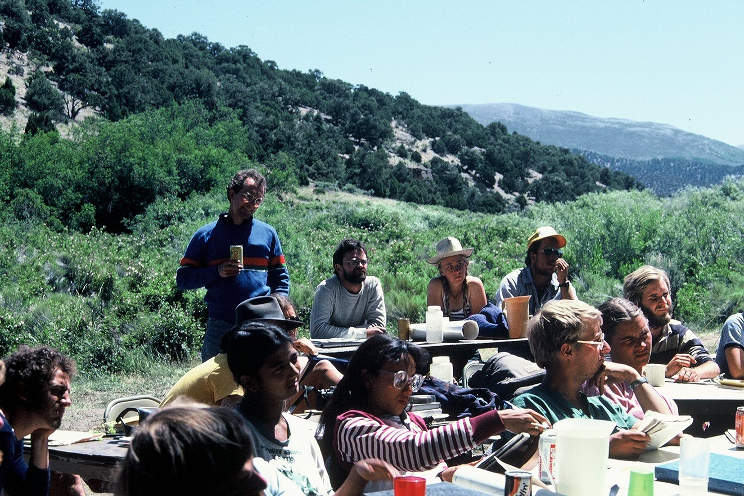
In 1983, a group of students and researchers in the Stanford Geological Survey share their field reports in the Northern Snake Range, Nevada. Dan Tormey, ’83, sits third from the right at the picnic bench. (Image credit: Elizabeth Miller)
“You can see that the older, deeper, and hotter rocks underwent this extreme pancake-like flattening and stretching in an east-west direction, while rocks above deformed by a myriad of faults, also in response to east-west stretching,” Miller said. “Geologically it’s super interesting because it is so unusual to see the deep levels of faults exposed and quite bizarre because of the amount of stretching represented. And people have gone back there over and over. We keep going back.”
The Northern Snake Range is distinguished from other metamorphic core complexes because of its exposed layers in both upper and lower plates that allow for calculations of the amount of deformation, or strain. The hotter and deeper rocks show the layers were thinned to as much as 10 percent of their original thickness. Miller and her research group have published many studies analyzing aspects of this deformation and the microscopic to atomic processes involved.
“The metamorphic core complex gives us important insight into how the Earth’s crust deforms, where you have exposed at the surface both very deep rock that is stretched and strained, overlain by fractured rock that is relatively intact except for multiple sets of faults,” said Dan Tormey, BS ’83, a former student in Miller’s class who mapped the Northern Snake Range and helped it to be named a First 100 Geological Heritage Site.
“It’s something we can use in figuring out other parts of the world that we have not mapped quite so well – a model hypothesis, if you will, for how to organize what you’re observing in other areas to test the theory that they formed in the same way as the Northern Snake Range,” he added.

A student discusses a geological map created with the Stanford Geological Survey in the 1980s. (Image credit: Elizabeth Miller)
The ideas for how the Northern Snake Range formed were controversial when the researchers first mapped the area in the 80s and 90s, and they are still debated today. Back then, Miller and students had one theory about how the range formed, while a Harvard professor had another – and he would send open letters to the students at the field camp advising them to keep rival hypotheses in mind while mapping, Tormey said.
“There was a battle for the minds of the youth that were out there, and it made us feel part of this revolutionary period, that we were working on something that was important,” Tormey said. “We weren’t just learning how to take measurements and record those accurately on a map – we were part of active research that was still highly controversial.”
The students grappled with the challenges of science in the field, learning to portray the geology in an accurate and objective way by making detailed maps that could be read and interpreted by others. Along the way, they also learned how to survive in the wilderness, navigate social situations in tight quarters, and figure out if they wanted a future in field work.
“So many undergraduate alumni have been through this field mapping program,” Miller said. “It was an experience that made them a lot more confident about themselves as scientists.”
A field legacy
When Miller was hired at Stanford in 1979, her main job was to continue the tradition of the Stanford Geological Survey field course previously run by geology legends Ben Page and Bob Compton, among others. The program had educated hundreds of Stanford undergraduates since its launch before the turn of the century. While the students didn’t all become geologists, the experience was often life changing.
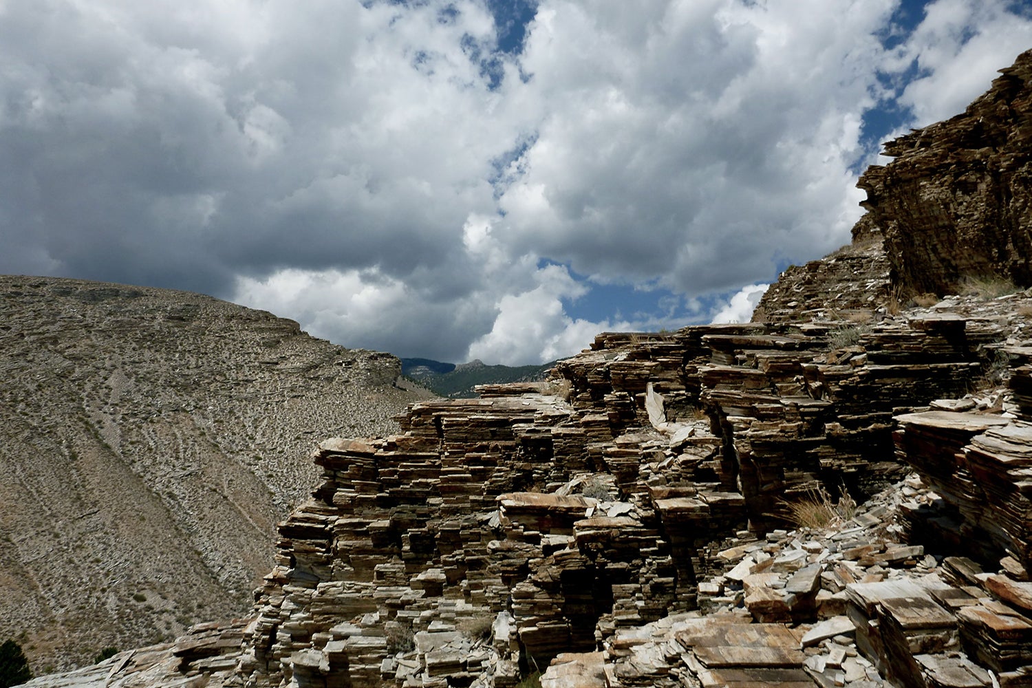
The Northern Snake Range in Nevada, displaying a well-developed example of a metamorphic core complex detachment fault, a type of fault formed during extension or stretching of the Earth’s crust. (Image credit: Elizabeth Miller)
“I was convinced that after that summer geology experience, nothing anyone could devise professionally would be too tough for me,” said Roland Mulchay, who participated in the 1925 field camp east of Paso Robles. His voices and others are documented in a 1988 volume of the history of the Geological Survey, in which Compton calls Miller “the best instructor of all. She’s so intense, so supportive. She’s made teaching the field of geology an art.”
Tormey said the field camp was inspiring, almost like a culture shock. And it gave him the confidence to pursue exploration of more daring sites as a volcanology student following his time at Stanford.
“It was really the field camp experience and learning how to live, and even thrive, in the wilderness that gave me the courage to do field work as a graduate student up on a remote 14,000-foot-high volcano in the Andes – and I lived there for three months,” he said.
Today, field classes at Stanford look a little different. They are often shorter and can include more accessible experiences that reflect a diversity of approaches to studying the Earth. What they all share, however, is a sense of discovery that gives participants new perspectives and outlooks on the world.
“If you’re in a natural science, then field experience is a really big piece of what natural science is: being out in the world and trying to figure it out,” Tormey said. “There was a saying that Elizabeth shared with us a lot: ‘The truth is in the field.’ ”

Professor Emerita Elizabeth Miller, center, and her students on a field trip to the Northern Snake Range in 2012. (Image credit: Elizabeth Miller)
Tormey, who conducts environmental reviews for government and industry with a consulting firm, proposed the Northern Snake Range for international recognition as part of an advisory group on geoheritage within the National Academy of Sciences. The group promotes the idea that geological sites should be preserved for their own geological heritage value, not simply as part of an ecosystem that supports the biodiversity of life on Earth.
“Most protected areas focus on species conservation, but there are other reasons to preserve areas besides biodiversity – the geological heritage is important as well,” Tormey said. “The geology is the stage upon which life occurs, and it’s important for that reason, but it’s also important for itself.”
In the U.S., the Northern Snake Range metamorphic core complex was among eight sites recognized for their importance in mineralogy, paleontology, and more, including the La Brea Tar Pits, the Yellowstone volcanic and hydrothermal system, and The Grand Canyon. The First 100 Geological Heritage Sites spanned 56 countries, and details may be found on the IUGS website.
“There was certainly an awareness of metamorphic core complexes and their importance, but there’s not a Grand Canyon of metamorphic core complexes that everybody knows about – and there should be,” Tormey said. “Hopefully, this will now create one: the Northern Snake Range.”
Branner Library hosts hundreds of digitized pieces from this collection that are freely available, from the earliest maps created in the late 1800s to Miller’s materials in the 1990s. To access physical maps, please visit the Stanford Libraries Special Collections.

Image credit: Andrew Brodhead
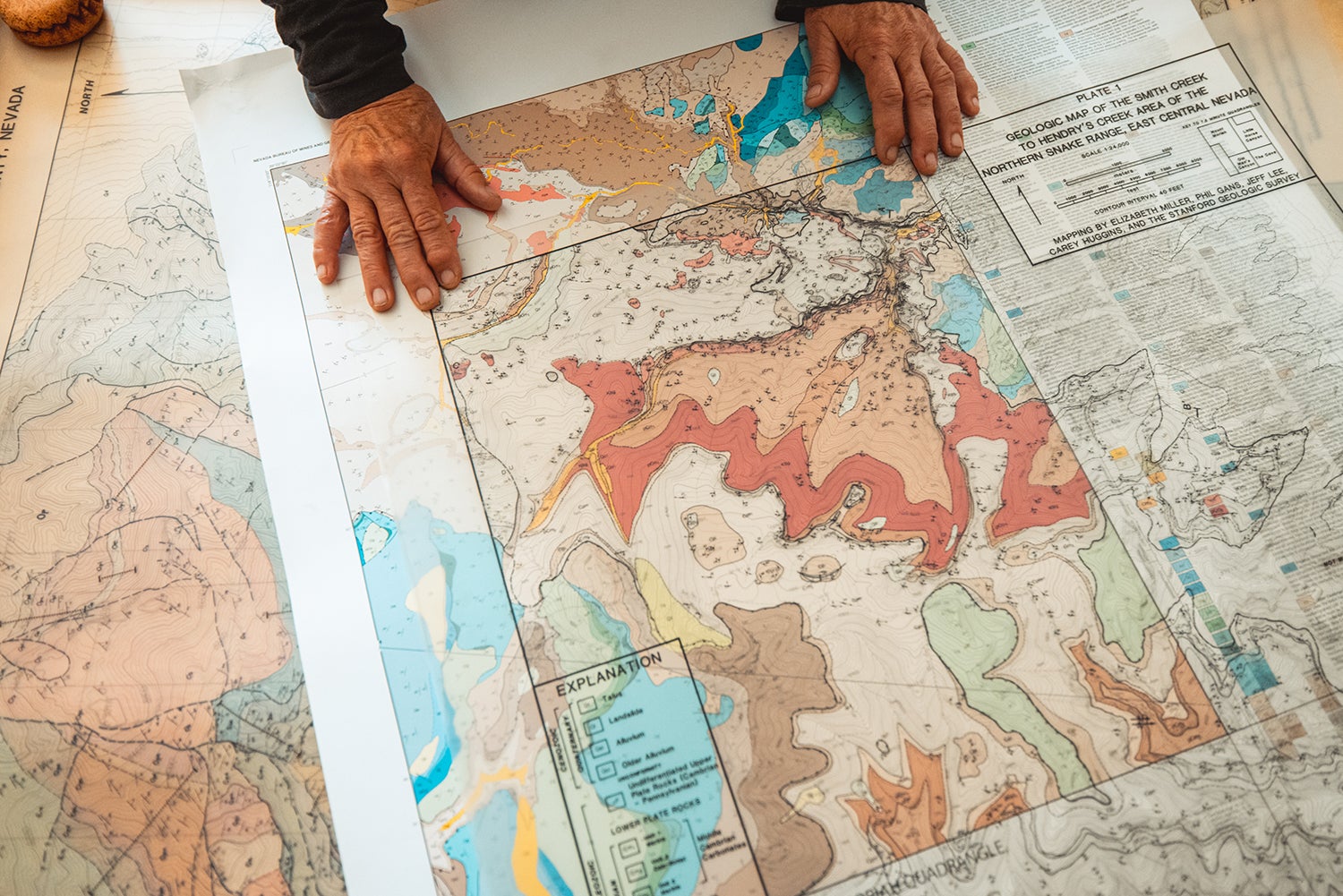
Image credit: Andrew Brodhead

Image credit: Andrew Brodhead
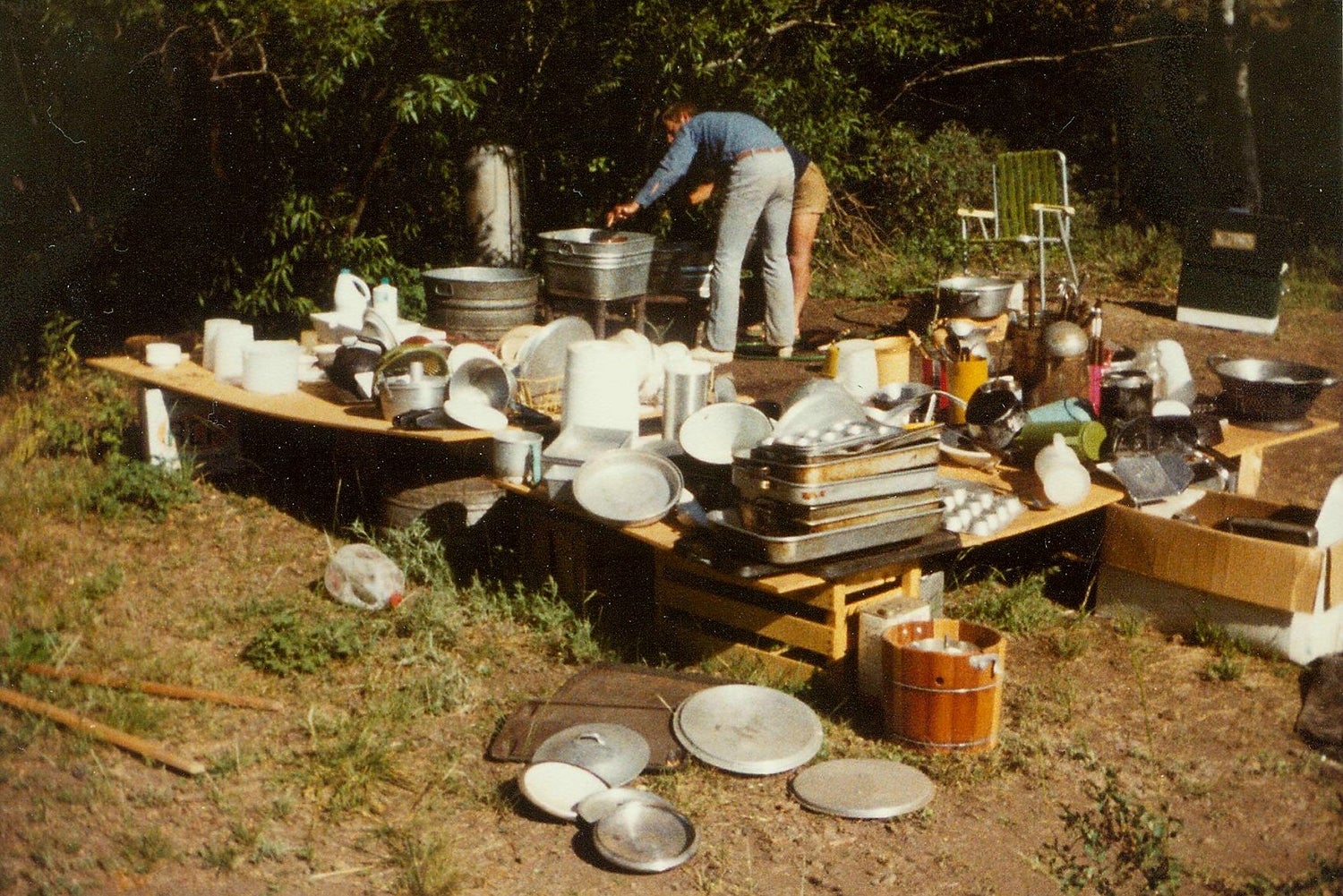
Image credit: Elizabeth Miller
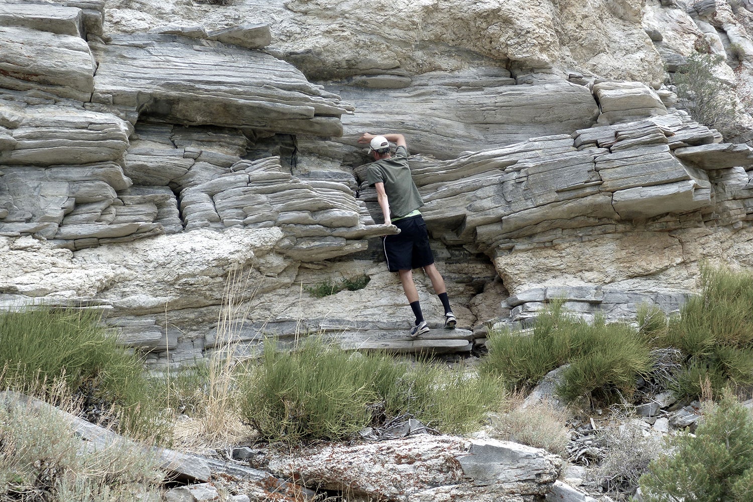
Image credit: Elizabeth Miller

Image credit: Elizabeth Miller
Author
Danielle Torrent Tucker