A team including Stanford researchers created a new digital archive to study Rome’s transformation over the centuries.

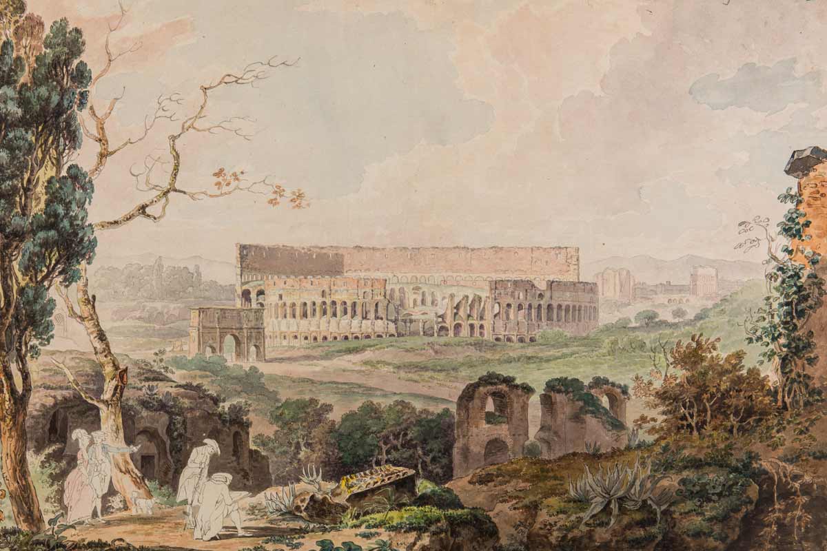
An 18th-century painting of the Colosseum by Francis Towne is part of the collection. (Image credit: Courtesy Istituto Nazionale di Archeologia e Storia dell’Arte)
The exhibit, which went online in the spring, consists of almost 4,000 digitized drawings, prints, photographs and sketches of historic Rome from the 16th to 20th centuries. The pieces were collected by renowned Roman archaeologist Rodolfo Lanciani, who sought to document the entire history of Rome’s archeology up to the end of the 19th century.
“Rome is a layered city,” said Erik Steiner, co-director of the Spatial History Project at Stanford’s Center for Spatial and Textual Analysis (CESTA). “To be able to see that history you need to look through those layers, and this collection helps that process.”
The archive is a culmination of a two-year collaboration among CESTA, the Stanford University Libraries, University of Oregon, Dartmouth College and the Italian government.
“This is part of our long-term ambition to bring one of the most documented cities in the world to the digital age,” Steiner said. “The project marries intense scholarly interest in Rome with best practices and tools built by the Stanford Libraries.”
An isolated treasure
After Lanciani’s death in 1929, his library, which contains more than 21,000 items, was sold to the Istituto Nazionale di Archeologia e Storia dell’Arte (Italy’s National Institute of Archaeology and Art History) in Rome.
Archaeologists, historians, architects and other researchers who study ancient cities have used the collection to glean valuable information about Rome’s history and structure.
“These materials are very important and have been used by many different scholars, but access to them is quite limited,” said Roman archaeologist Giovanni Svevo, who also worked on the digital archive.

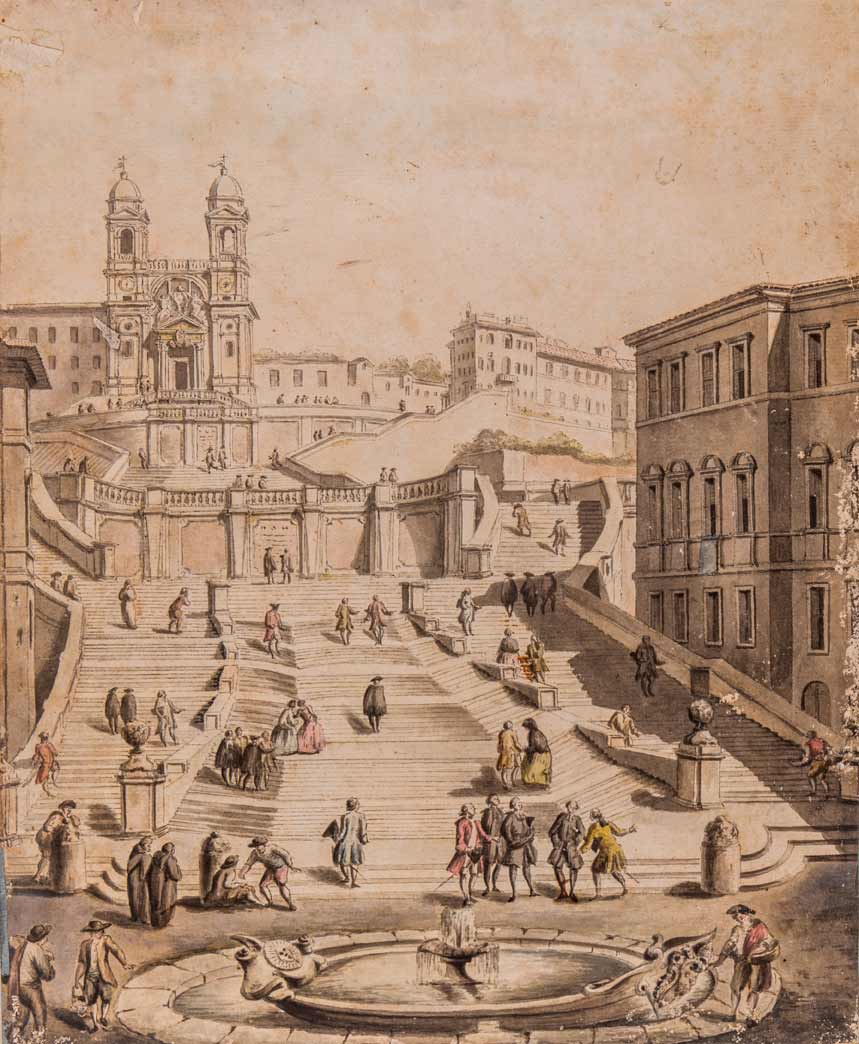
An 18th-century painting of the Spanish Steps by Francesco Panini (Image credit: Courtesy of Istituto Nazionale di Archeologia e Storia dell’Arte)
Viewing the archive requires a visit to the historic 15th-century Palazzo Venezia in central Rome. Lanciani’s collection is on the fourth floor and in its own dedicated room, which is open for only a few hours during weekdays. Only one folder from the collection can be viewed at a time.
So the team – Steiner, Svevo, James Tice, a principal investigator on the project and an architecture professor at the University of Oregon, and Nicola Camerlenghi, an assistant professor of art history at Dartmouth College – set out to bring some of the collection onto the internet.
Supported by a 2015 grant from the Samuel H. Kress Foundation, they partnered with Italy’s Ministry of Cultural Heritage and Activities and Tourism and the National Institute to scan and create high-resolution images of each of the thousands of materials in the collection.
“Our collaboration with the Italian government on this project was very important,” Camerlenghi said. “It’s such a big help to scholars across the world when such teamwork can occur.”
Each digital object was categorized and tied to a descriptive set of data, so it could be properly stored and searched online. This part of the project demanded the most effort and care, the researchers said.
The digital images and all associated descriptions are now permanently preserved in the Stanford Digital Repository.
“We believe this project is important for two reasons: it provides accessibility to a precious archival collection and, more broadly, it demonstrates a method whereby similar materials can be made available to scholars, students and the general public through the digital humanities,” Tice said.
Recreating the past
Digitizing Lanciani’s collection is part of a larger effort to recreate the spatial history of Rome, a project named “Mapping Rome,” that Steiner and Tice began around 2004 with Allan Ceen, director of Studium Urbis, an institute devoted to the study of Rome’s urban history.
As part of that effort, the team digitized the work of two 18th-century Italian architects, Giambattista Nolli and Giuseppe Vasi. They are also still working on completing the digitization of Lanciani’s famous Forma Urbis Romae, a cartographic map that traces Rome’s ancient ruins and its later developments. The map is 17 feet by 24 feet and is considered to have the most detailed information about Rome’s historical topography.
The team envisions the end product to be an interactive map of Rome that links to the digitized archival materials.
“This is about telling a story of a place and reconstructing its past,” Steiner said.
Beside allowing access to any scholar in the world, digitizing the archives also ensures their future preservation, Steiner emphasized. He said he hopes that more libraries and institutions around the world will devote time and funding to digitizing the humanities’ enormous body of historical documents.
“Nothing in the end would substitute holding primary documents in your hands, but you can answer a lot of scholarly questions by looking at them online in high resolution,” Camerlenghi said.
Media Contacts
Alex Shashkevich, Stanford News Service: (650) 497-4419, ashashkevich@stanford.edu