
Dry weather causing fire concerns at Dish and on Matadero Trail
Stanford fire and land management officials want hikers who frequent the Dish or Matadero Trail to be aware that the National Weather Service may issue a Red Flag warning because of imminent critical fire weather patterns. As a result, the Dish hiking area and the Matadero Trail may be closed without warning.
Posters cautioning hikers about possible future Red Flag fire warnings have been hung at the Dish hiking area and at the Matadero Trail.
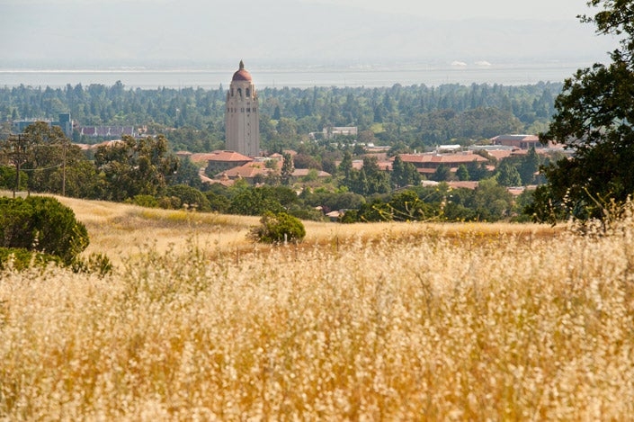
Fire concerns for the area around the Dish may lead to closure of hiking trails. (Image credit: L.A. Cicero)
That means that at any time and without warning, the Dish and Matadero Trail could be closed to hikers because of an increased likelihood of fires in the foothills.
Red Flag warnings are issued by the National Weather Service to warn firefighters and land management agencies that the conditions are ideal for wildfires to spread rapidly. No Red Flag warnings have been issued at this point, but the continuing dry weather has increased the possibility of fires in the foothills.
Stanford’s Department of Public Safety has hung posters warning of the possibility of closure due to fire concerns at the entrances to both the Dish and the Matadero Trail. Should the Dish area and Matedero Trail be actually closed, hikers would be evacuated, the entrance gates would be locked and a red flag would be hung at the entrance, signifying the fire danger.
According to M. Jovan Solis, the zone administrator who oversees the Dish area and the program manager of the Foothill Management Group, the National Weather Service bases its warnings and closures on such conditions as existing fires in the area, dryness and weather patterns.
“The Stanford foothills, including the Dish and Matadero Trail, are extremely dry due to the hot weather we have had this summer,” she said. “We are expecting the rest of summer to be quite warm, so the Foothills Management Group is taking extra precaution to ensure the safety of users and hikers of Stanford foothills.”
Currently in Santa Clara County, there is a fire involving about 150 acres southwest of Gilroy. That fire, according to the Cal Fire website, started on Sunday, July 23, and is now 70 percent contained. This summer, county fires have also been reported in San Jose, on Mount Hamilton and northeast of Morgan Hill.
Solis said Stanford Building and Grounds crew members have increased the amount of mowing done around Dish-area pathways to create fire breaks that could diminish the ability of a fire to spread. The Department of Public Safety also will increase patrols in the Dish and Matadero Trail areas.
Although fires are uncommon on the Stanford campus, the ones that have occurred have caused damage, especially during the summer when the ground is especially dry. In July 2015, for instance, the crash of a remote-controlled model airplane started a brush fire in the Lagunita lakebed. In July 2007, a 20-acre grass fire near the Dish resulted in the temporary closure of Junipero Serra Boulevard from Stanford Avenue to Campus Drive East. During that fire, electricity was briefly shut off to about 2,000 area homes.
For more information, visit the National Weather Service’s California Fire Weather website.